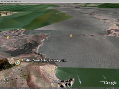
Golden Gate Bridge vista point (by Google Earth)
Do you remember my previous post about the Golden Gate Bridge (for those who didn't look at it, please click on the link below) ?
http://travelphotographies.blogspot.com/2005/08/san-francisco-gate-to-pacific-ocean.html
Thanks to Google Earth features, I could find the way to drive until the vista point that allows to see the bridge in a entire piece...
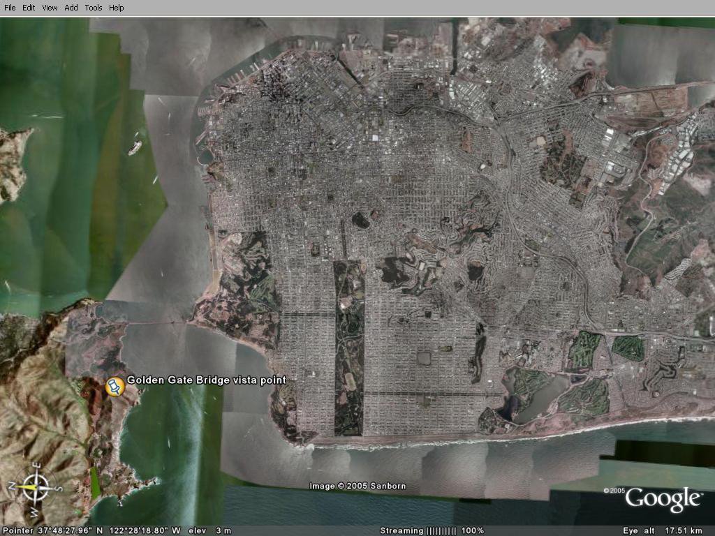
As you can see on the map, you have to go that far from San Francisco... (that's the yellow mark)

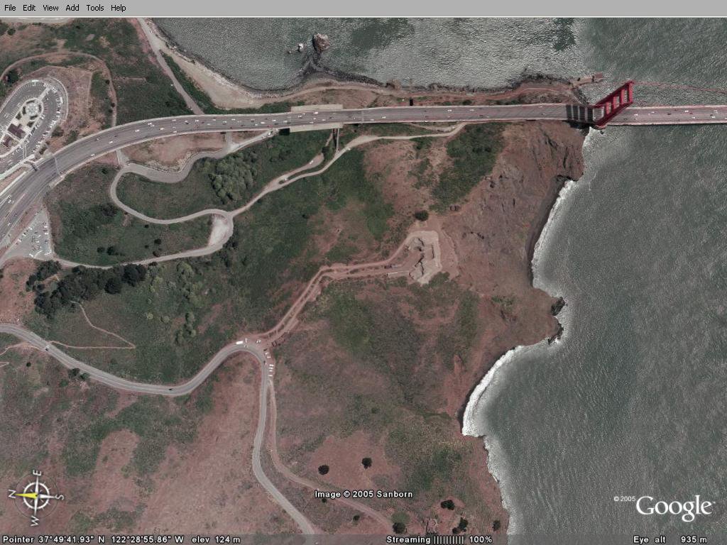
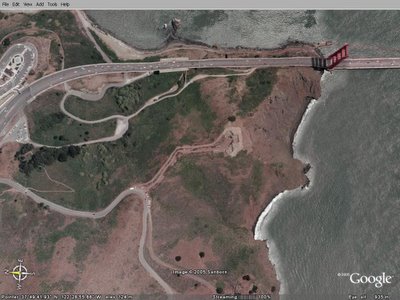 After crossing the bridge, you follow the road, you don't stop at the first parking, here on the left just after the bridge...you turn right at the yellow mark.
This turn makes you pass under the raod you were previously.
You always go straight.
You don't stop at the first vista point that people use to stop & go. That's a nice spot, because you can take pictures with the pillar just in front of you. Go & see if you wish, but don't turn back !!
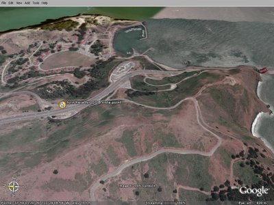
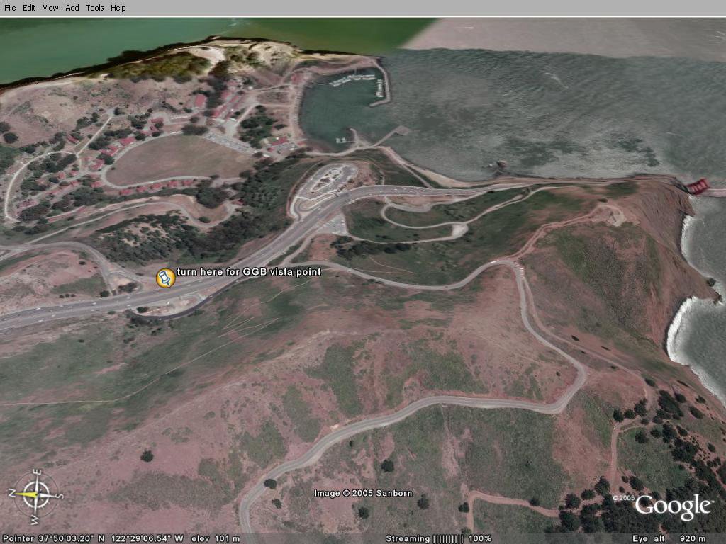
See where the vista point is ? you have to follow this road until the end.
You'll see a lot of spots where to park and have a look on the bridge, but don't panic, the best is at the yellow spin.

As you can see, when you stop there, you've just reached the highest point in the area.
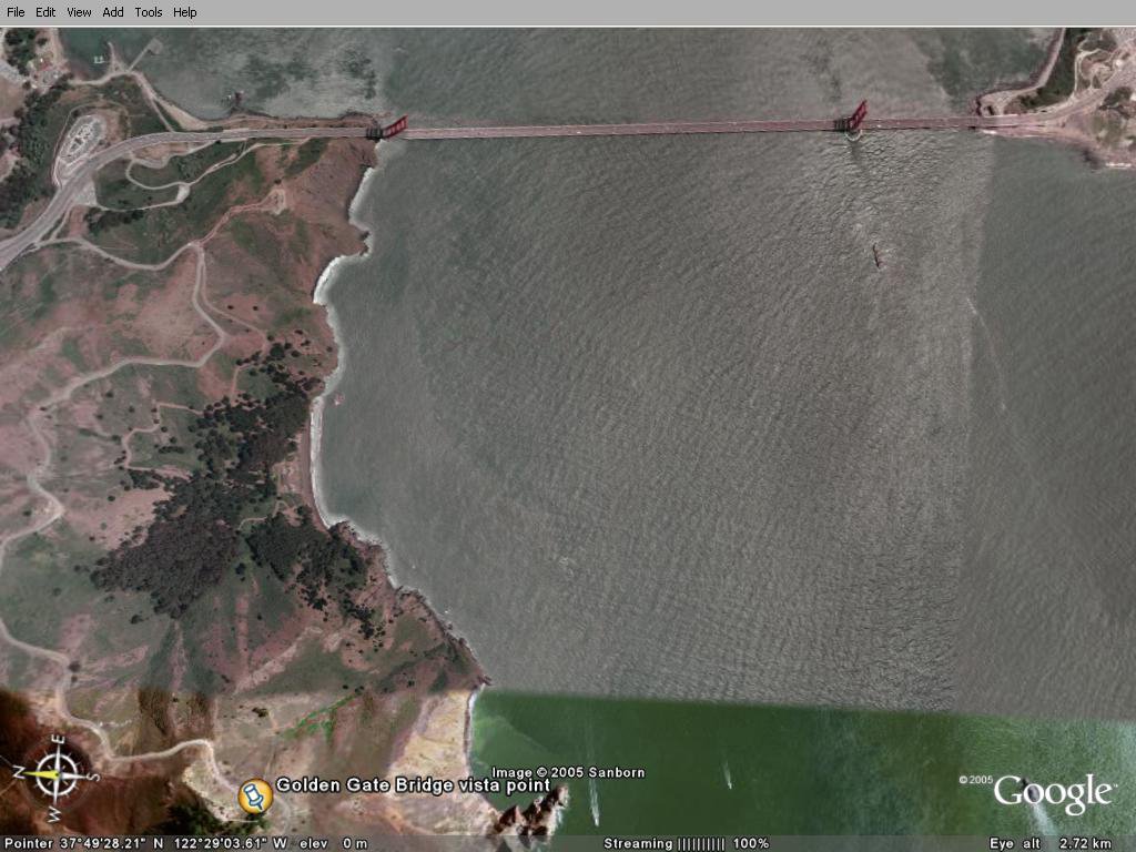
This spot is a dead end road, you'll have to turn back... from where you came.
I hope if one day you'll go to San Francisco (and you should do it, trust me), you'll remember that excellent vista point !!
cheers
Olivier
http://travelphotographies.blogspot.com/2005/08/san-francisco-gate-to-pacific-ocean.html
Thanks to Google Earth features, I could find the way to drive until the vista point that allows to see the bridge in a entire piece...
As you can see on the map, you have to go that far from San Francisco... (that's the yellow mark)
 After crossing the bridge, you follow the road, you don't stop at the first parking, here on the left just after the bridge...you turn right at the yellow mark.
This turn makes you pass under the raod you were previously.
You always go straight.
You don't stop at the first vista point that people use to stop & go. That's a nice spot, because you can take pictures with the pillar just in front of you. Go & see if you wish, but don't turn back !!
See where the vista point is ? you have to follow this road until the end.
You'll see a lot of spots where to park and have a look on the bridge, but don't panic, the best is at the yellow spin.
As you can see, when you stop there, you've just reached the highest point in the area.
This spot is a dead end road, you'll have to turn back... from where you came.

I hope if one day you'll go to San Francisco (and you should do it, trust me), you'll remember that excellent vista point !!
cheers
Olivier


Comments